About Cahaba Blueway
Project Background
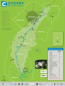
The Cahaba River flows for 191 miles through the heart of Alabama, connecting some of our state’s most populated and wealthy communities with some of our most rural and economically undeveloped areas. The Cahaba is an incredibly rich natural asset, recognized as one of the most biologically diverse and beautiful rivers in North America. Currently, the Cahaba River is only marginally developed for public recreation. However, through modest investment in infrastructure and public information, it has tremendous potential to become a broadly valued local and national recreational destination that will support economic development and quality of life in Cahaba Blueway Communities.
The University of Alabama Center for Economic Development (UACED) is working in partnership with the Cahaba River Society, The Nature Conservancy, Cahaba Riverkeeper, Freshwater Land Trust, and the National Park Service’s Rivers, Trails, and Conservation Assistance Program to realize the Cahaba’s potential through the Cahaba Blueway initiative. This program is creating a formal “water trail” on the Cahaba by providing the infrastructure and information needed to make accessing the river easier and the branding that will make the trail marketable. Similar water trails elsewhere in the Southeast and across the country have expanded opportunities for hospitality and retail business while making nearby communities more livable and attractive to prospective residents.
Program Development
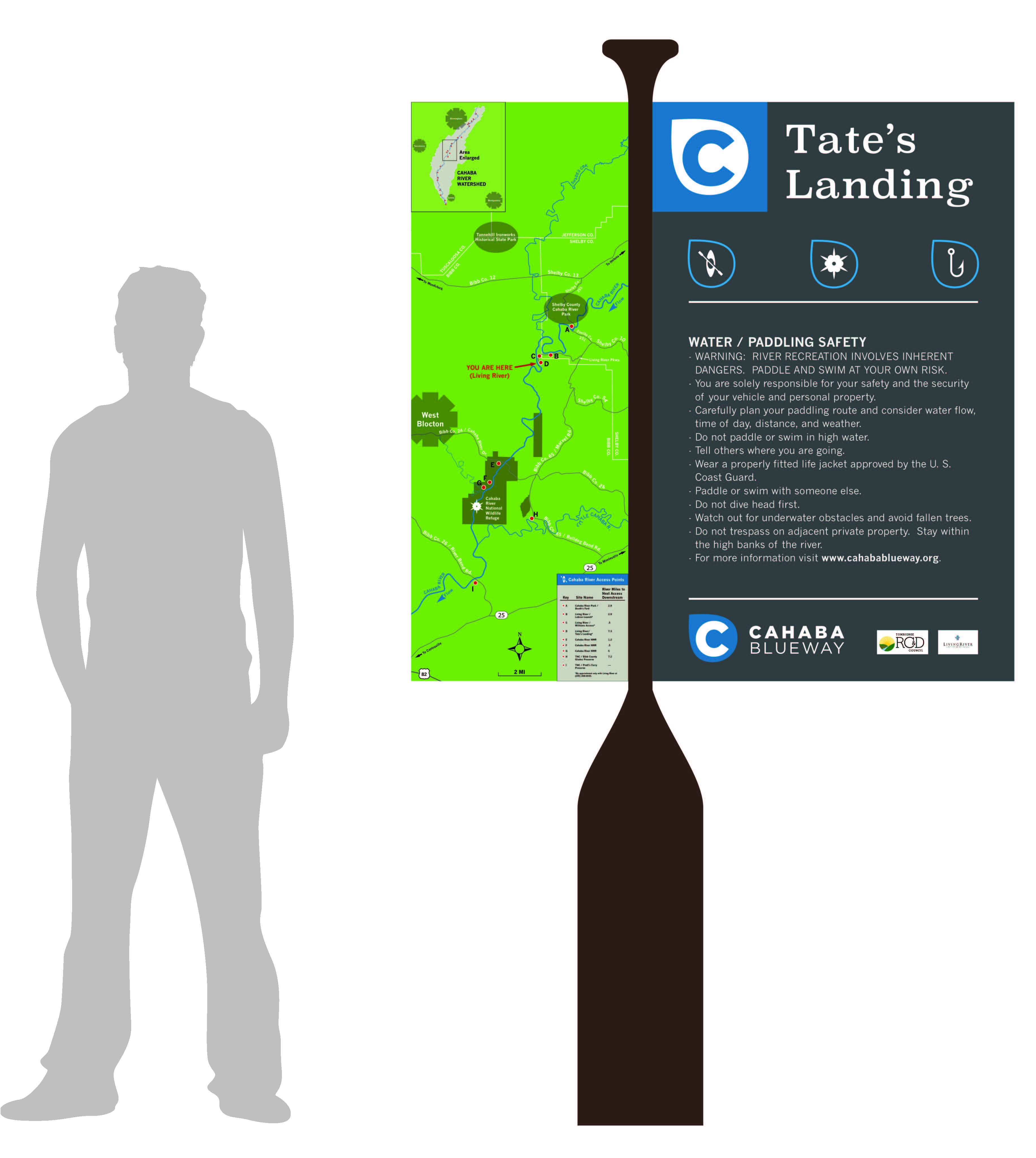
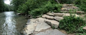
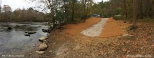
Working with multiple public and private organizations and with input from the general public, the Cahaba Blueway partnership has developed a distinctive brand for the Cahaba Blueway and guidelines for standardized way-finding signage that we are encouraging communities to use when developing their own access points along the river. The brand is distinctive and recognizable, and the signs provide important and easy-to-understand location and safety information that enables visitors to have an enjoyable experience on the river. We have also created guidelines for developing river access infrastructure that we are encouraging communities to use to design and construct accesses that are safe, environmentally sustainable, and durable. Access infrastructure improvement projects completed at Grants Mill in Irondale and at the Williams Access at Living River demonstrate the successful application of these practices.
Resource Documents
Through a public engagement process and with the help of the National Park Service’s Rivers, Trails, and Conservation Assistance Program, the Cahaba Blueway partnership has developed the following guideline documents that we encourage local governments and other partners to use as key references when planning and developing new Cahaba Blueway access points. Access points that meet the benchmark of safe, environmentally sustainable, and durable may become officially designated Cahaba Blueway accesses. Click the links to download PDF files of each guideline document.
Wayfinding Guidelines
Best Practices for Access Design and Construction
Steering Committee Organizations


PARTNER TRAIL SYSTEMS
The Cahaba Blueway is proud to partner with the following trail systems: